Picture 1 of 4


Gallery
Picture 1 of 4


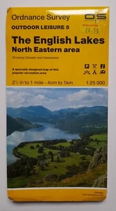
English Lakes North Eastern Area Ordnance Survey 2 1/2 Inch to a mile map - 1989
GBP 3.00
ApproximatelyAU $6.27
Condition:
“Signs of wear. Crushing of corners / edges. Price sticker on front. See photos.”
Good
A book that has been read but is in good condition. Very minimal damage to the cover including scuff marks, but no holes or tears. The dust jacket for hard covers may not be included. Binding has minimal wear. The majority of pages are undamaged with minimal creasing or tearing, minimal pencil underlining of text, no highlighting of text, no writing in margins. No missing pages. See the seller’s listing for full details and description of any imperfections.
- Buy It NowEnglish Lakes North Eastern Area Ordnance Survey 2 1/2 Inch to a mile map - 1989
Oops! Looks like we're having trouble connecting to our server.
Refresh your browser window to try again.
Postage:
GBP 13.04 (approx. AU $27.25) International Priority Shipping to United States via eBay's Global Shipping Program.
Located in: Coventry, United Kingdom
Import charges:
Free amount confirmed at checkout
Delivery:
Estimated between Fri, 9 May and Fri, 16 May
Includes international tracking
Returns:
No returns accepted.
Payments:
Shop with confidence
Seller assumes all responsibility for this listing.
eBay item number:116383889539
Item specifics
- Condition
- Good
- Seller notes
- “Signs of wear. Crushing of corners / edges. Price sticker on front. See photos.”
- Publication Year
- 1989
- Type
- Map
- Language
- English
- Publication Name
- The English Lakes North Eastern Area
- Format & Map Type
- Ordnance Survey/Local Map
- Country
- England
- Publisher
- Ordnance Survey
Item description from the seller
Seller feedback (708)
- u***0 (467)- Feedback left by buyer.Past 6 monthsVerified purchaseVery good seller. Very carefully packaged, well priced & quickly dispatched. Great communication too. A++++++
- r***g (10)- Feedback left by buyer.Past yearVerified purchaseAbsolute pleasure! Lovely little item in great condition (as described), well priced with cheap P&P. Great communication from the seller and item arrived very quickly and packaged very well to avoid damage. Perfect! :)Vintage - The Friendly Match Maguire and Paterson Dublin 1 1/2p - no matches. (#116343895693)
- e***b (289)- Feedback left by buyer.Past monthVerified purchaseGreat condition as described and arrived promptly and well packaged. Great seller!
More to explore:
- Ordnance Survey Maps & Atlases in English,
- Ordnance Survey Maps & Atlases,
- Ordnance Survey Folding Map Maps & Atlases,
- Ordnance Survey United Kingdom Maps & Atlases,
- Ordnance Survey 2010-Now Publication Year Maps & Atlases,
- Maps & Atlases in English,
- Sydney Maps & Atlases in English,
- European Maps & Atlases in English,
- Street Maps/Directories in English,
- Greece Maps & Atlases in English